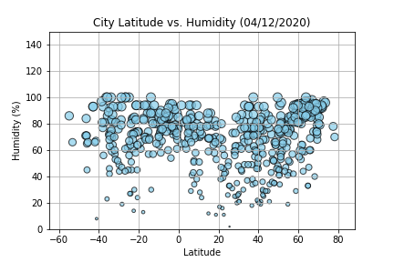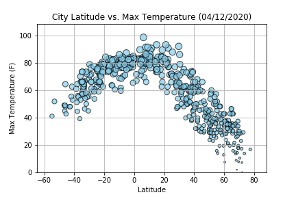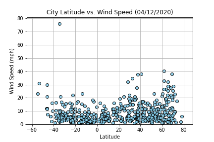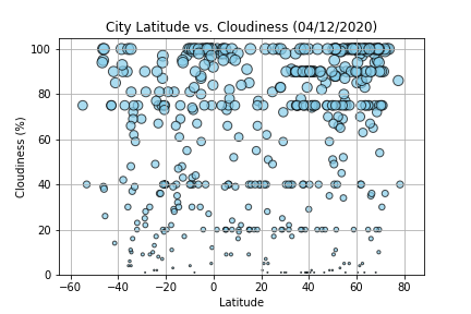
According to the Environmental Literacy Council, "Latitude provides the location of a place north or south of the equator and is expressed by angular measurements ranging from 0° at the equator to 90° at the poles. Different latitudes on Earth receive different amounts of sunlight, and are a key factor in determining a region’s climate. For example, the higher the latitude of a given place (the farther away it is from the equator), the sharper the angle of the sun’s rays that reach it, meaning that the rays of the sun are spread across a broader area. Therefore, higher latitudes receive less heat than lower latitude areas nearer the equator."
In this project, I’ll be creating a Python script to visualize the weather of 500+ cities across the world of varying distance from the equator. To accomplish this, I'll be utilizing a simple Python library, the OpenWeatherMap API, and a little common sense to create a representative model of weather across world cities.